About the Technology

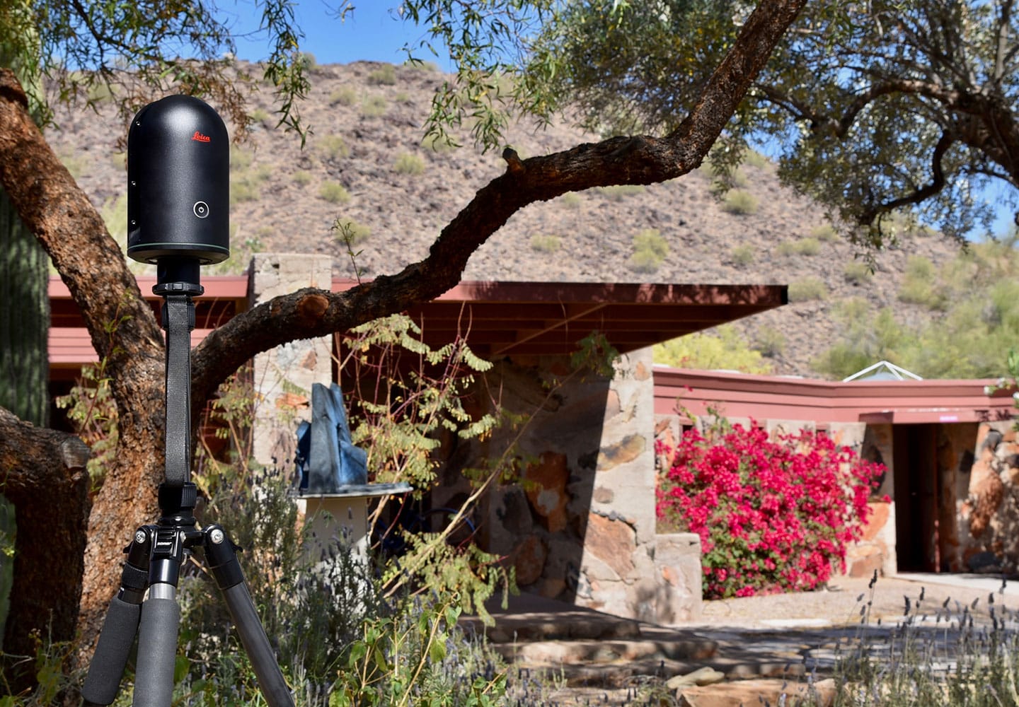
The online Taliesin West experience was created using technology and services from Leica Geosystems, Multivista and Matterport. It goes beyond traditional 3D renderings, documentation, and virtual online tours by capturing the property from every dimension – the exterior grounds and the interior home along with architectural details including 3D views and floorplans.

Leica BLK360

The Leica BLK360 was used to capture the property. It is the world’s smallest, fastest and most simple to use 3D imaging laser scanner. The BLK360 provides the Frank Lloyd Wright Foundation with data in two ways. The first is the 360º spherical imagery that feeds the visual immersive experience. The second comes in the form of a point cloud, a dimensionally accurate laser reproduction of the property that can be used for the Foundation's preservation efforts. The point cloud can even be loaded in popular CAD and BIM software for highly accurate renovations and careful design changes should the need arise.

Learn More

Multivista

Multivista, a global provider of progressive construction documentation and software services, provided their reality capture expertise and conducted the on-site scans of Taliesin West. They also compiled the data to create the most realistic experience possible.

Learn More

Matterport

Leica Geosystems partner, Matterport, an immersive 3D media technology company, provided its Matterport Pro2 3D camera and cloud platform. Both the BLK360 and the Matterport Pro2 camera feed visual data into the Matterport 3D Showcase, where the Taliesin West virtual tour is experienced. Matterport’s technology made it easy to create, modify and navigate the 3D version of Taliesin West.

Learn More


“Leica’s history is steeped in engineering and our centuries-long reputation was built on the ability to deliver the most precise tools for measurement and accuracy. As we’ve evolved into the digital age, we bring that rich history and commitment with us as illustrated by our work with the Frank Lloyd Wright Foundation.”

— Burkhard Boeckem, CTO of Hexagon's Geosystems Division

About The Partnership

The Frank Lloyd Wright Foundation is proudly joining together with Leica Geosystems and Multivista—harnessing their digital innovations to preserve Wright’s work and to enable the world to experience his architecture in new ways.


“True to our mission, the Frank Lloyd Wright Foundation is dedicated to preserving Taliesin and Taliesin West for future generations. Through our partnership with Leica Geosystems, we’re able to carry our mission, and Wright’s vision into the future, by making Taliesin West available to the world so they can experience his ideas, architecture and design in new ways.”

— Stuart Graff, President and CEO of the Frank Lloyd Wright Foundation

Leica Geosystems – when it has to be right. Revolutionizing the world of measurement and survey for nearly 200 years, Leica Geosystems is the industry leader in measurement and information technologies. We create complete solutions for professionals across the planet.

Learn More

The first in full service documentation, the leader in technological innovation. True to our mission since 2003, Multivista pioneers advanced documentation services to deliver our valued clients the most relevant, accurate and comprehensive project information available.

Learn More

Back to 3D Lab